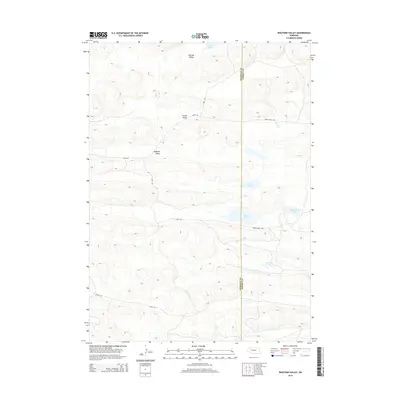
2014 Map of Wolford Valley
USGS Topo · Published 2014About this map
Wolford Valley and the surrounding Nebraska Sandhills are defined by a scattered network of ephemeral lakes and wide depressions. This 2014 survey captures a landscape of low relief where water bodies like Hebbert Lake, Short Lake, and Home Lake punctuate the arid terrain. The map documents the boundary between Sheridan and Cherry counties, an area primarily utilized for ranching as evidenced by the presence of Spade Ranch Rd. Other prominent basins include Big Hill Valley and Survey Valley, while interestingly named water features such as Bean Soup Lake and Big Dad Lake highlight the local nomenclature of this ranching country. Transportation is limited to rugged tracks like 277th Trl and 330th Trl, reflecting the sparse settlement of this high-plains environment.
Find a feature on this map
16 named features on this map. Tap any name to fly to it.
Don’t see what you’re looking for? This feature index may not catch every label — zoom into the map to look around manually.
Map Details
Editions of this 2014 Wolford Valley Map
This is the sole edition of this map. No revisions or reprints were ever made.
Other maps of this area

1948 · Ashby
USGS Topo · 1:62,500

1948 · Bingham
USGS Topo · 1:62,500

1948 · Spade Ranch
USGS Topo · 1:62,500

1949 · Ashby
USGS Topo · 1:62,500

1949 · Turpin Lake
USGS Topo · 1:62,500

1950 · Spade Ranch
USGS Topo · 1:62,500

1950 · Bingham
USGS Topo · 1:62,500

1951 · Turpin Lake
USGS Topo · 1:62,500

1955 · Alliance
USGS Topo · 1:250,000

1957 · Alliance
USGS Topo · 1:250,000