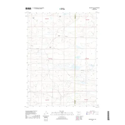
2017 Map of Wolford Valley
USGS Topo · Published 2017About this map
Wolford Valley and the surrounding Sandhills landscape are defined by a collection of isolated lakes and private ranch roads along the Sheridan Co Cherry Co line. This 2017 study illustrates the sparse, cattle-ranching character of the Nebraska panhandle, where named valleys like Big Hill Valley and Survey Valley provide a sense of place in an otherwise uniform terrain. The hydrology of the area is distinct, featuring scattered bodies of water including Hebbert Lake, Short Lake, and the uniquely named Bean Soup Lake. Transportation through the region relies on a network of numbered trails and ranch-specific arteries such as Spade Ranch Rd and King Ranch Rd. These tracks connect remote ranching operations to larger surveying landmarks like Home Lake and Big Dad Lake, reflecting the enduring land-use patterns of Cherry County.
Find a feature on this map
23 named features on this map. Tap any name to fly to it.
Don’t see what you’re looking for? This feature index may not catch every label — zoom into the map to look around manually.
Map Details
Editions of this 2017 Wolford Valley Map
This is the sole edition of this map. No revisions or reprints were ever made.
Other maps of this area

1948 · Ashby
USGS Topo · 1:62,500

1948 · Bingham
USGS Topo · 1:62,500

1948 · Spade Ranch
USGS Topo · 1:62,500

1949 · Ashby
USGS Topo · 1:62,500

1949 · Turpin Lake
USGS Topo · 1:62,500

1950 · Spade Ranch
USGS Topo · 1:62,500

1950 · Bingham
USGS Topo · 1:62,500

1951 · Turpin Lake
USGS Topo · 1:62,500

1955 · Alliance
USGS Topo · 1:250,000

1957 · Alliance
USGS Topo · 1:250,000