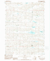
1989 Map of Wolford Valley
USGS Topo · Published 1989About this map
Wolford Valley and Survey Valley define the rolling sandhill terrain of the Nebraska panhandle, where cattle ranching is the primary footprint on the land. In the late 1980s, the area remained a network of isolated homesteads and family holdings, including the P Strasburger Ranch and E Strasburger Ranch. The map captures a way of life centered on widely spaced water sources and rural education, evidenced by the Spade Sch and the various Spade Ranch outposts. A series of distinctive depressions in the landscape hold notable water bodies like Bean Soup Lake, Big Dad Lake, and Home Lake, which are essential for livestock in this arid environment. The line between Sheridan Co and Cherry Co bisects the eastern portion of the map, marking a quiet administrative boundary across the vast plains.
Find a feature on this map
17 named features on this map. Tap any name to fly to it.
Don’t see what you’re looking for? This feature index may not catch every label — zoom into the map to look around manually.
Map Details
Editions of this 1989 Wolford Valley Map
This is the sole edition of this map. No revisions or reprints were ever made.
Other maps of this area

1948 · Ashby
USGS Topo · 1:62,500

1948 · Bingham
USGS Topo · 1:62,500

1948 · Spade Ranch
USGS Topo · 1:62,500

1949 · Ashby
USGS Topo · 1:62,500

1949 · Turpin Lake
USGS Topo · 1:62,500

1950 · Spade Ranch
USGS Topo · 1:62,500

1950 · Bingham
USGS Topo · 1:62,500

1951 · Turpin Lake
USGS Topo · 1:62,500

1955 · Alliance
USGS Topo · 1:250,000

1957 · Alliance
USGS Topo · 1:250,000