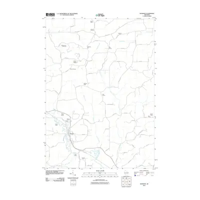
2010 Map of Wonewoc
USGS Topo · Published 2010About this map
Wonewoc sits at the heart of this landscape where the Baraboo River winds through a valley defined by prominent ridges and sandstone outcrops. The village is flanked by the distinctive Castle Rocks and the Three Castles Airpark, while the surrounding countryside is marked by several family and parish burial grounds including Saint Paul Cemetery, Pine Eden Cemetery, and Hochmuth Cemetery. This 2010 survey shows a rural environment where land is divided by geographic landmarks like Mullin Ridge, Pleasant Ridge, and Daylight Hill. The water network is particularly detailed, tracing the paths of Crossman Creek, Gardner Creek, and Stewart Creek as they feed the river. Local infrastructure is noted through several small-scale dams such as the Walsh H2198 Dam and Leverenz H 35 Dam, alongside the small settlement at Plum Valley.
Find a feature on this map
80 named features on this map. Tap any name to fly to it.
Don’t see what you’re looking for? This feature index may not catch every label — zoom into the map to look around manually.
Map Details
Editions of this 2010 Wonewoc Map
This is the sole edition of this map. No revisions or reprints were ever made.
Other maps of this area

1919 · Kendall
USGS Topo · 1:62,500

1921 · Mauston
USGS Topo · 1:62,500

1921 · Kendall
USGS Topo · 1:62,500

1927 · Hillsboro
USGS Topo · 1:62,500

1956 · Reedsburg
USGS Topo · 1:62,500

1958 · La Crosse
USGS Topo · 1:250,000

1961 · La Crosse
USGS Topo · 1:250,000

1962 · Kendall
USGS Topo · 1:62,500

1962 · Mauston
USGS Topo · 1:62,500

1965 · La Crosse
USGS Topo · 1:250,000