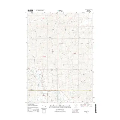
2016 Map of Wonewoc
USGS Topo · Published 2016About this map
The Baraboo River carves a deep path through the driftless-style terrain of central Wisconsin, anchoring the village of Wonewoc. This 2016 survey illustrates a landscape defined by dramatic ridges and narrow valleys, where family-named landforms like Mullin Ridge, Pleasant Ridge, and Potter Ridge rise above the drainage of Crossman Cr and Gardner Cr. The settlement pattern remains deeply rooted in the area's 19th-century foundations, evidenced by the numerous small burying grounds dotting the hills, including Saint Anns Cem and Saint Peters Cem.
Find a feature on this map
96 named features on this map. Tap any name to fly to it.
Don’t see what you’re looking for? This feature index may not catch every label — zoom into the map to look around manually.
Map Details
Editions of this 2016 Wonewoc Map
This is the sole edition of this map. No revisions or reprints were ever made.
Other maps of this area

1919 · Kendall
USGS Topo · 1:62,500

1921 · Mauston
USGS Topo · 1:62,500

1921 · Kendall
USGS Topo · 1:62,500

1927 · Hillsboro
USGS Topo · 1:62,500

1956 · Reedsburg
USGS Topo · 1:62,500

1958 · La Crosse
USGS Topo · 1:250,000

1961 · La Crosse
USGS Topo · 1:250,000

1962 · Kendall
USGS Topo · 1:62,500

1962 · Mauston
USGS Topo · 1:62,500

1965 · La Crosse
USGS Topo · 1:250,000