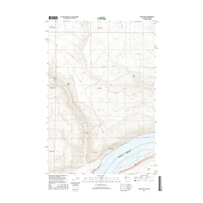
2017 Map of Wood Gulch
USGS Topo · Published 2017About this map
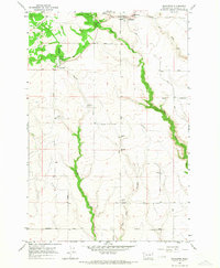
Roosevelt sits along the northern shore of Lake Umatilla, occupying a narrow strip of land where the high desert plateau of Klickitat County meets the Columbia River. This landscape is defined by deep incisions in the basalt terrain, including Wood Gulch, Juniper Canyon, and Big Horn Canyon, which drain toward the river. The settlement at Roosevelt is connected to the interior uplands by a network of local routes such as Roosevelt Elevator Rd and Woodgulch Rd, reflecting the area's agricultural and transportation infrastructure. Seasonal watercourses like Pine Cr and Coyote Cr carve through the arid slopes, while the state boundary between Washington and Oregon follows the center of the lake. To the southeast, the terrain levels out at Hurlburt Flats, illustrating the transition from steep canyon walls to the flatter river benches.
Find a feature on this map
19 named features on this map. Tap any name to fly to it.
Don’t see what you’re looking for? This feature index may not catch every label — zoom into the map to look around manually.
Map Details
Editions of this 2017 Wood Gulch Map
This is the sole edition of this map. No revisions or reprints were ever made.
Other maps of this area

1916 · Arlington
USGS Topo · 1:125,000

1953 · The Dalles
USGS Topo · 1:250,000

1956 · The Dalles
USGS Topo · 1:250,000

1957 · The Dalles
USGS Topo · 1:250,000
1962 · Douty Canyon
USGS Topo · 1:24,000

1962 · Heppner Junction
USGS Topo · 1:24,000
1962 · Crider Valley
USGS Topo · 1:24,000

1962 · Wood Gulch
USGS Topo · 1:24,000
1964 · Horn Butte
USGS Topo · 1:24,000
1965 · Bickleton
USGS Topo · 1:24,000