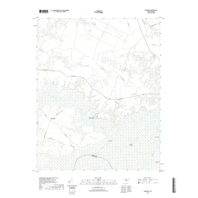
2019 Map of Woodard
USGS Topo · Published 2019About this map
Sans Souci and Woodard anchor this low-lying riverine landscape where the Cashie River and Roanoke River systems converge in eastern North Carolina. The map depicts a complex hydrologic network of creeks, sloughs, and pocosins, with the Buckleberry Pocosin dominating the northern terrain and the Middle River branching through the southern wetlands. The rural character of Bertie Co and Martin Co is defined by these watercourses, which historically dictated settlement patterns and transport, as evidenced by names like Hymans Ferry Rd.
Find a feature on this map
35 named features on this map. Tap any name to fly to it.
Don’t see what you’re looking for? This feature index may not catch every label — zoom into the map to look around manually.
Map Details
Editions of this 2019 Woodard Map
This is the sole edition of this map. No revisions or reprints were ever made.
Other maps of this area

1904 · Edenton
USGS Topo · 1:62,500

1942 · Edenton
USGS Topo · 1:62,500

1943 · Plymouth
USGS Topo · 1:125,000

1943 · Edenton
USGS Topo · 1:62,500

1953 · Norfolk
USGS Topo · 1:250,000

1953 · Rocky Mount
USGS Topo · 1:250,000

1954 · Rocky Mount
USGS Topo · 1:250,000

1954 · Plymouth East
USGS Topo · 1:24,000

1954 · Westover
USGS Topo · 1:24,000
1978 · Jamesville
USGS Topo · 1:24,000