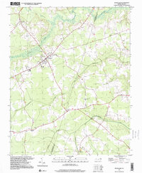
1997 Map of Woodard
USGS Topo · Published 2000About this map
Woodland sits at a geographic crossroads in the late twentieth century, anchoring a landscape where the rural settlements of George, Eagletown, and Mintons Store are connected by a network of winding county roads. The terrain is defined by its low-lying hydrology, dominated by the sluggish waters of Urahaw Swamp and the meandering paths of Catawhiskie Creek and Potecasi Creek. These waterways and their associated floodplains have historically dictated the placement of farms and small communities.
Find a feature on this map
23 named features on this map. Tap any name to fly to it.
Don’t see what you’re looking for? This feature index may not catch every label — zoom into the map to look around manually.
Map Details
Editions of this 1997 Woodard Map
This is the sole edition of this map. No revisions or reprints were ever made.
Other maps of this area

1904 · Edenton
USGS Topo · 1:62,500

1942 · Edenton
USGS Topo · 1:62,500

1943 · Plymouth
USGS Topo · 1:125,000

1943 · Edenton
USGS Topo · 1:62,500

1953 · Norfolk
USGS Topo · 1:250,000

1953 · Rocky Mount
USGS Topo · 1:250,000

1954 · Rocky Mount
USGS Topo · 1:250,000

1954 · Plymouth East
USGS Topo · 1:24,000

1954 · Westover
USGS Topo · 1:24,000
1978 · Jamesville
USGS Topo · 1:24,000