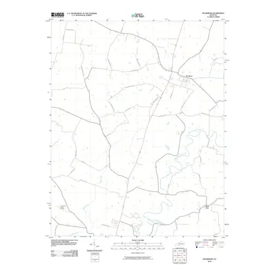
2010 Map of Woodburn
USGS Topo · Published 2010About this map
The settlement of Woodburn serves as the focal point of this Simpson County landscape, situated where the terrain begins to slope toward the winding West Fork Drakes Creek. This 2010 survey illustrates a region defined by agricultural heritage and family-named landmarks, such as Arnemann Farms Airport and a dense network of rural corridors like Harvey Robertson Rd and Oscar Downey Rd. The mapping of several ford roads, including Saddler Ford Rd and Ditmore Ford Rd, reveals traditional crossing points across the local waterways that have likely dictated travel patterns for generations.
Find a feature on this map
34 named features on this map. Tap any name to fly to it.
Don’t see what you’re looking for? This feature index may not catch every label — zoom into the map to look around manually.
Map Details
Editions of this 2010 Woodburn Map
This is the sole edition of this map. No revisions or reprints were ever made.
Other maps of this area

1921 · Bowling Green
USGS Topo · 1:62,500

1923 · Bowling Green
USGS Topo · 1:62,500

1928 · Adolphus
USGS Topo · 1:48,000

1931 · Adolphus
USGS Topo · 1:62,500

1942 · Gallatin
USGS Topo · 1:100,000

1951 · Woodburn
USGS Topo · 1:24,000

1951 · Franklin
USGS Topo · 1:24,000

1951 · Prices Mill
USGS Topo · 1:24,000

1951 · Auburn
USGS Topo · 1:24,000

1951 · South Union
USGS Topo · 1:24,000