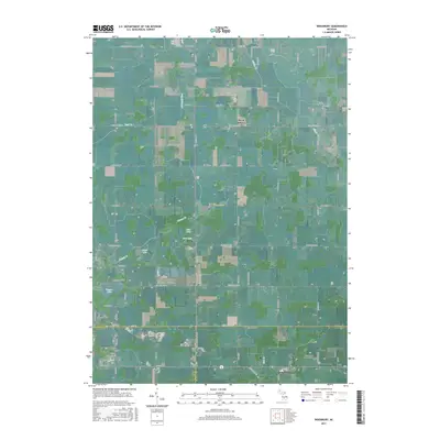
2017 Map of Woodbury
USGS Topo · Published 2017About this map
The tri-county junction of Ionia, Barry, and Eaton counties serves as the focal point for this rural Michigan landscape. The small settlement of Woodbury sits at the southern edge, while the village of Sunfield occupies the southeastern corner. This area is characterized by a high concentration of small, family-associated water bodies and drainage systems, including Tupper Lake, Augst Lake, and Peacock Ditch. Genealogists will find significant value in the documentation of local burial grounds such as Alderman Cem, Lakeside Cem, and the Sebewa Baptist Cem. The township boundaries—t6n r7w, t6n r6w, t5n r7w, and t5n r6w—organize a grid of rural roads like S State Rd and Kelsey Hwy that connect the dispersed communities of West Sebewa and the nearby Stony Acres Airport.
Find a feature on this map
75 named features on this map. Tap any name to fly to it.
Don’t see what you’re looking for? This feature index may not catch every label — zoom into the map to look around manually.
Map Details
Editions of this 2017 Woodbury Map
This is the sole edition of this map. No revisions or reprints were ever made.
Other maps of this area

1916 · Ionia
USGS Topo · 1:62,500

1918 · Ionia
USGS Topo · 1:62,500

1943 · Ionia
USGS Topo · 1:62,500

1945 · Portland
USGS Topo · 1:62,500

1949 · Charlotte
USGS Topo · 1:62,500

1950 · Nashville
USGS Topo · 1:62,500

1951 · Nashville
USGS Topo · 1:62,500

1958 · Grand Rapids
USGS Topo · 1:250,000

1961 · Grand Rapids
USGS Topo · 1:250,000

1962 · Grand Rapids
USGS Topo · 1:250,000