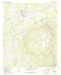
1971 Map of Woodbury
USGS Topo · Published 1986About this map
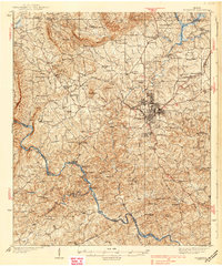
The Seaboard Coast Line and Southern Railway converge at Woodbury, a critical rail junction in western Georgia during the mid-to-late 20th century. This 1971 survey, updated in the early 1980s, captures a transition from traditional agrarian life to modern infrastructure, illustrated by the proximity of the Flint River Academy and the broadcast facilities of Radio Tower (WFDR) to family-named landmarks. The landscape is defined by the sharp rise of Pine Mountain and Betts Mountain, which channel numerous tributaries like Pound Creek and Cane Creek toward the Flint River at the eastern edge of the quadrangle.
Find a feature on this map
72 named features on this map. Tap any name to fly to it.
Don’t see what you’re looking for? This feature index may not catch every label — zoom into the map to look around manually.
Map Details
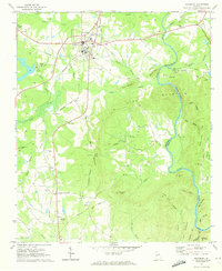
Editions of this 1971 Woodbury Map
2 editions found
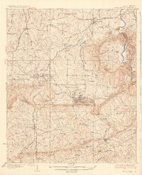
Other maps of this area

1907 · Talbotton
USGS Topo · 1:125,000
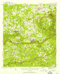
1934 · Warm Springs
USGS Topo · 1:62,500

1935 · Thomaston
USGS Topo · 1:48,000
1936 · Warm Springs
USGS Topo · 1:62,500
1939 · Thomaston
USGS Topo · 1:62,500

1953 · Atlanta
USGS Topo · 1:250,000

1955 · Phenix City
USGS Topo · 1:250,000

1957 · Phenix City
USGS Topo · 1:250,000

1957 · Atlanta
USGS Topo · 1:250,000

1958 · Phenix City
USGS Topo · 1:250,000