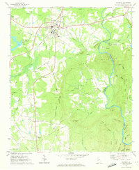
1971 Map of Woodbury
USGS Topo · Published 1973About this map
Woodbury serves as the central hub of this Georgia landscape, where the Southern Railroad and the Seaboard Coast Line intersect near the High Sch. The surrounding terrain is defined by the significant rise of Pine Mountain and its many wooded ridges, which are dissected by deep hollows like Cove Hollow and Keenan Hollow. Along the southern slopes, small agricultural and residential nodes such as Loftin, Johnson Crossroads, and Persico are connected by a network of rural roads and an old railroad grade.
Find a feature on this map
71 named features on this map. Tap any name to fly to it.
Don’t see what you’re looking for? This feature index may not catch every label — zoom into the map to look around manually.
Map Details
Editions of this 1971 Woodbury Map
2 editions found
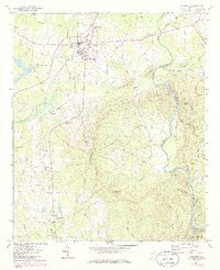
Other maps of this area

1907 · Talbotton
USGS Topo · 1:125,000

1934 · Warm Springs
USGS Topo · 1:62,500

1935 · Thomaston
USGS Topo · 1:48,000

1936 · Warm Springs
USGS Topo · 1:62,500

1939 · Thomaston
USGS Topo · 1:62,500

1953 · Atlanta
USGS Topo · 1:250,000

1955 · Phenix City
USGS Topo · 1:250,000

1957 · Phenix City
USGS Topo · 1:250,000

1957 · Atlanta
USGS Topo · 1:250,000

1958 · Phenix City
USGS Topo · 1:250,000