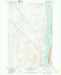
1978 Map of Wooded Island
USGS Topo · Published 1979About this map
Hanford Works dominates this stretch of the Columbia River in the late 1970s, revealing the infrastructure of the nuclear age alongside the natural geography of the Pasco Basin. The landscape is a stark mix of security-sensitive development and riverine features, characterized by the U. S. Government Railroad slicing diagonally through a terrain of Sand Dunes and Radioactive Waste Dump sites.
Find a feature on this map
26 named features on this map. Tap any name to fly to it.
Don’t see what you’re looking for? This feature index may not catch every label — zoom into the map to look around manually.
Map Details
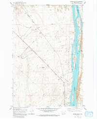
Editions of this 1978 Wooded Island Map
2 editions found
Other maps of this area

1917 · Pasco
USGS Topo · 1:125,000

1924 · Hanford
USGS Topo · 1:62,500

1925 · Scooteney Lake
USGS Topo · 1:62,500

1951 · Scooteney Lake
USGS Topo · 1:62,500

1951 · Richland
USGS Topo · 1:62,500

1951 · Hanford
USGS Topo · 1:62,500

1953 · Walla Walla
USGS Topo · 1:250,000

1958 · Walla Walla
USGS Topo · 1:250,000

1965 · Mesa
USGS Topo · 1:62,500

1965 · Eltopia
USGS Topo · 1:62,500