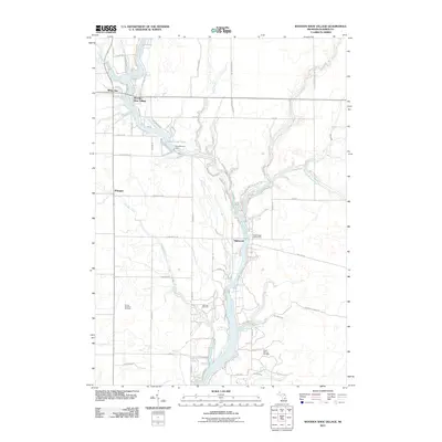
2011 Map of Wooden Shoe Village
USGS Topo · Published 2011About this map
The Tittabawassee River and its numerous tributaries dominate this Gladwin County landscape, where water-driven geography defines the local development pattern. At the heart of the map, the Smallwood Dam impounds the river to form Smallwood Lake, a central feature surrounded by residential clusters like Wooden Shoe Village and White Star. These communities, along with Winegars to the west, illustrate the area's history as a hub for both river-based recreation and industrial utility.
Find a feature on this map
68 named features on this map. Tap any name to fly to it.
Don’t see what you’re looking for? This feature index may not catch every label — zoom into the map to look around manually.
Map Details
Editions of this 2011 Wooden Shoe Village Map
This is the sole edition of this map. No revisions or reprints were ever made.
Other maps of this area

1954 · Traverse City
USGS Topo · 1:250,000

1954 · Midland
USGS Topo · 1:250,000

1958 · Traverse City
USGS Topo · 1:250,000

1958 · Midland
USGS Topo · 1:250,000

1959 · Midland
USGS Topo · 1:250,000

1966 · Midland
USGS Topo · 1:250,000

1968 · Sterling SW
USGS Topo · 1:24,000

1969 · Wagarville
USGS Topo · 1:24,000

1969 · Gladwin
USGS Topo · 1:24,000
1969 · Hope
USGS Topo · 1:24,000