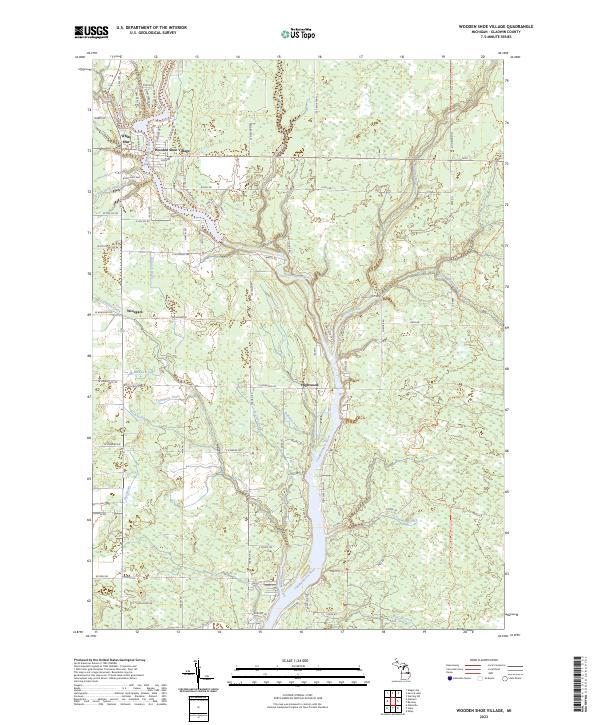
2023 Map of Wooden Shoe Village
USGS Topo · Published 2023About this map
The Tittabawassee River carves a deep north-south path through this Gladwin County landscape, serving as the central geographic feature for the small settlements of Wooden Shoe Village, Winegars, and Highwood. The river's winding course is fed by a complex network of tributaries, including the Molasses River and Little Molasses River to the east, and several drains such as Le Clear Drain and Robbins Drain that reflect the area's hydraulic management for agriculture and forestry.
Find a feature on this map
98 named features on this map. Tap any name to fly to it.
Don’t see what you’re looking for? This feature index may not catch every label — zoom into the map to look around manually.
Map Details
Editions of this 2023 Wooden Shoe Village Map
This is the sole edition of this map. No revisions or reprints were ever made.
Other maps of this area

1954 · Traverse City
USGS Topo · 1:250,000

1954 · Midland
USGS Topo · 1:250,000

1958 · Traverse City
USGS Topo · 1:250,000

1958 · Midland
USGS Topo · 1:250,000

1959 · Midland
USGS Topo · 1:250,000

1966 · Midland
USGS Topo · 1:250,000

1968 · Sterling SW
USGS Topo · 1:24,000

1969 · Wagarville
USGS Topo · 1:24,000

1969 · Gladwin
USGS Topo · 1:24,000
1969 · Hope
USGS Topo · 1:24,000