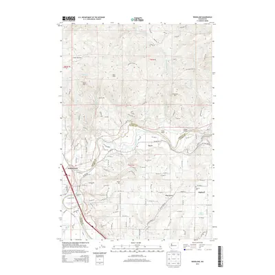
2013 Map of Woodland
USGS Topo · Published 2013About this map
The Woodland townsite occupies the bottomlands at the confluence of the Lewis River and Horseshoe Lake, where the boundary between Cowlitz and Clark counties follows the ancient river bends. This early 21st-century landscape is defined by the transition from the river valley floor to the prominent peaks of the Cascade foothills, including Ross Peak, Devils Peak, and Schumaker Mtn. The drainage patterns are clearly marked by Little Kalama River and Ross Cr as they move through the upland terrain toward the Lewis.
Find a feature on this map
126 named features on this map. Tap any name to fly to it.
Don’t see what you’re looking for? This feature index may not catch every label — zoom into the map to look around manually.
Map Details
Editions of this 2013 Woodland Map
This is the sole edition of this map. No revisions or reprints were ever made.
Other maps of this area

1921 · Kalama
USGS Topo · 1:62,500

1922 · St. Helens
USGS Topo · 1:62,500

1940 · La Center
USGS Topo · 1:62,500

1941 · St Helens
USGS Topo · 1:62,500

1943 · Pigeon Springs
USGS Topo · 1:62,500

1943 · St Helens
USGS Topo · 1:62,500

1948 · Vancouver
USGS Topo · 1:250,000

1950 · Vancouver
USGS Topo · 1:250,000

1950 · Vancouver
USGS Topo · 1:250,000

1953 · Hoquiam
USGS Topo · 1:250,000