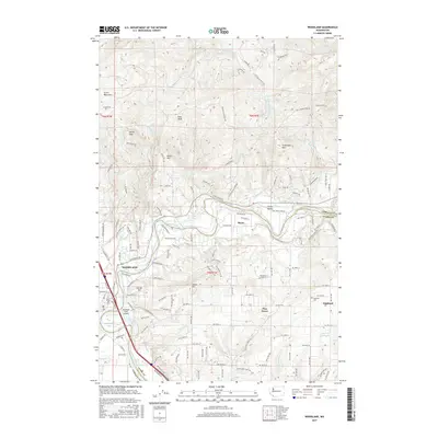
2017 Map of Woodland
USGS Topo · Published 2017About this map
The Lewis River divides the landscape as it flows past the established community of Woodland toward its confluence with the Columbia. In 2017, this area at the border of Cowlitz and Clark Counties reflects a mixture of riverfront industry and upland residential growth. To the west, the Woodland State Airport and Horseshoe Lake mark the lower floodplains, while the terrain rises sharply to the east into the foothills of Green Mountain and Devils Peak.
Find a feature on this map
104 named features on this map. Tap any name to fly to it.
Don’t see what you’re looking for? This feature index may not catch every label — zoom into the map to look around manually.
Map Details
Editions of this 2017 Woodland Map
This is the sole edition of this map. No revisions or reprints were ever made.
Other maps of this area

1921 · Kalama
USGS Topo · 1:62,500

1922 · St. Helens
USGS Topo · 1:62,500

1940 · La Center
USGS Topo · 1:62,500

1941 · St Helens
USGS Topo · 1:62,500

1943 · Pigeon Springs
USGS Topo · 1:62,500

1943 · St Helens
USGS Topo · 1:62,500

1948 · Vancouver
USGS Topo · 1:250,000

1950 · Vancouver
USGS Topo · 1:250,000

1950 · Vancouver
USGS Topo · 1:250,000

1953 · Hoquiam
USGS Topo · 1:250,000