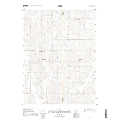
2018 Map of Woodland
USGS Topo · Published 2018About this map
Woodland sits within a landscape defined by the winding course of the Weldon River and its numerous tributaries, including Steel Cr, Hog Cr, and Turkey Run. This rural area straddles the border between Decatur Co and Wayne Co, where a network of county roads like Co Rd J46 and Woodland Ave connect dispersed homesteads. The map reveals a dense concentration of small burial grounds that suggest a long-established agricultural community, featuring Cunningham Cem, Lentz Cem, Shields Cem, and Big Springs Cem. Other local landmarks such as Gollough Cem, Corder Cem, and Hayes Cem are tucked into the drainages of Caleb Cr and surrounding ridges, reflecting the traditional settlement patterns of southern Iowa.
Find a feature on this map
34 named features on this map. Tap any name to fly to it.
Don’t see what you’re looking for? This feature index may not catch every label — zoom into the map to look around manually.
Map Details
Editions of this 2018 Woodland Map
This is the sole edition of this map. No revisions or reprints were ever made.
Other maps of this area

1934 · Humeston
USGS Topo · 1:48,000

1937 · Corydon
USGS Topo · 1:62,500

1954 · Centerville
USGS Topo · 1:250,000

1957 · Centerville
USGS Topo · 1:250,000

1958 · Centerville
USGS Topo · 1:250,000

1964 · Woodland
USGS Topo · 1:24,000

1964 · Pleasanton
USGS Topo · 1:24,000

1964 · Cleopatra
USGS Topo · 1:24,000

1964 · Leon
USGS Topo · 1:24,000

1964 · Clio
USGS Topo · 1:24,000