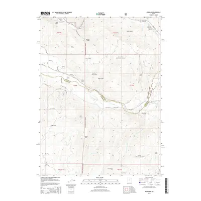
2014 Map of Woodland
USGS Topo · Published 2014About this map
Kamas Valley serves as a transition point between the rugged high-elevation forest land and the agricultural openings of Summit and Wasatch Counties. This 2014 survey documents the dense network of canyons and drainages defining the western edge of the Uinta Mountains, including Moon Canyon, Red Pine Canyon, and the appropriately named Failure Canyon. The landscape is dominated by the Wasatch National Forest and Uinta National Forest, where high-mountain recreation is represented by several sites like Shingle Creek Campground and Oakcrest Camp. Cultural history is anchored by the Woodland Cem and the Kamas Fish Hatchery in the northwest. Significant water systems are traced in detail, from the Provo River and Little S Fork Provo River to numerous smaller mountain creeks like Beaver Cr and Bench Cr.
Find a feature on this map
67 named features on this map. Tap any name to fly to it.
Don’t see what you’re looking for? This feature index may not catch every label — zoom into the map to look around manually.
Map Details
Editions of this 2014 Woodland Map
This is the sole edition of this map. No revisions or reprints were ever made.
Other maps of this area

1885 · Salt Lake
USGS Topo · 1:250,000

1900 · Coalville
USGS Topo · 1:125,000

1903 · Coalville
USGS Topo · 1:125,000

1907 · Strawberry Valley
USGS Topo · 1:125,000

1909 · Strawberry Valley
USGS Topo · 1:125,000

1954 · Salt Lake City
USGS Topo · 1:250,000

1958 · Salt Lake City
USGS Topo · 1:250,000

1960 · Salt Lake City
USGS Topo · 1:250,000

1967 · Francis
USGS Topo · 1:24,000

1967 · Kamas
USGS Topo · 1:24,000