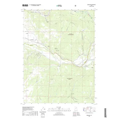
2020 Map of Woodland
USGS Topo · Published 2020About this map
Woodland and Francis anchor the western edge of this survey, serving as the primary mountain gateways where the high valleys of the Wasatch Range transition into protected wilderness. The landscape is dominated by the sprawling boundaries of the Wasatch National Forest and Uinta National Forest, which encompass a dense network of canyons and peaks. Life here centers on the water systems, notably the Provo River and S Fork Provo River, which wind through the terrain near landmarks like Potters Knoll. Local history is preserved at the Woodland Cem just north of the river, while the surrounding area is defined by a modern grid of forest access routes including Red Pine Canyon Rd and various ATV trails. The topographic detail highlights the complex drainage patterns of Rileys Canyon and Herd Hollow, illustrating the drainage into the major river forks that characterize this portion of Summit and Wasatch counties.
Find a feature on this map
63 named features on this map. Tap any name to fly to it.
Don’t see what you’re looking for? This feature index may not catch every label — zoom into the map to look around manually.
Map Details
Editions of this 2020 Woodland Map
This is the sole edition of this map. No revisions or reprints were ever made.
Other maps of this area

1885 · Salt Lake
USGS Topo · 1:250,000

1900 · Coalville
USGS Topo · 1:125,000

1903 · Coalville
USGS Topo · 1:125,000

1907 · Strawberry Valley
USGS Topo · 1:125,000

1909 · Strawberry Valley
USGS Topo · 1:125,000

1954 · Salt Lake City
USGS Topo · 1:250,000

1958 · Salt Lake City
USGS Topo · 1:250,000

1960 · Salt Lake City
USGS Topo · 1:250,000

1967 · Francis
USGS Topo · 1:24,000

1967 · Kamas
USGS Topo · 1:24,000