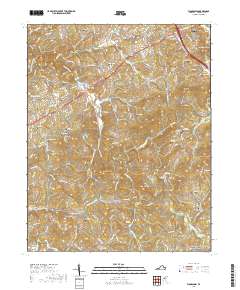
2019 Map of Woodlawn
USGS Topo · Published 2019About this map
Hillsville and the surrounding Carroll County countryside are defined by a complex network of ridges and watercourses, including the notable peaks of Walker Knob and Chisel Knob. This area of Southwest Virginia showcases a legacy of family and community identity through its numerous burial grounds, such as Woodlawn Cem, Gardner Cem, and the Williams-Jenkins Cem. Transportation routes like State Rte 781 and Pipers Gap Rd wind through the hills, connecting smaller settlements like Pipers Gap and Higgins Crossroads. In the northern section, the Thomas L Fells Memorial Bridge crosses a tributary near Woodlawn, while the southern reaches are bordered by the iconic Blue Ridge Parkway. The landscape is etched by various branches of Crooked Creek, which provides drainage for the many knobs and hollows that characterize this portion of the Blue Ridge plateau.
Find a feature on this map
146 named features on this map. Tap any name to fly to it.
Don’t see what you’re looking for? This feature index may not catch every label — zoom into the map to look around manually.
Map Details
Editions of this 2019 Woodlawn Map
This is the sole edition of this map. No revisions or reprints were ever made.
Other maps of this area

1889 · Hillsville
USGS Topo · 1:125,000

1892 · Hillsville
USGS Topo · 1:125,000

1896 · Hillsville
USGS Topo · 1:125,000

1930 · Max Meadows
USGS Topo · 1:62,500

1931 · Galax
USGS Topo · 1:48,000

1933 · Galax
USGS Topo · 1:62,500

1953 · Winston-Salem
USGS Topo · 1:250,000

1955 · Winston-Salem
USGS Topo · 1:250,000

1956 · Macks Mountain
USGS Topo · 1:62,500

1957 · Mount Airy
USGS Topo · 1:62,500