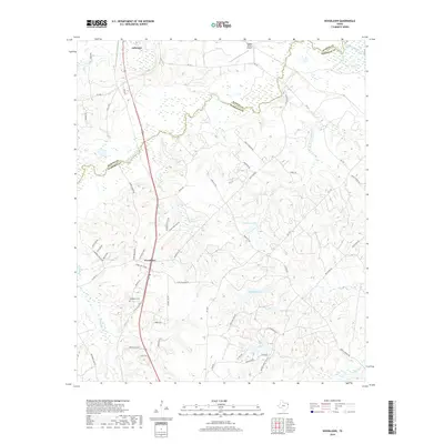
2019 Map of Woodlawn
USGS Topo · Published 2019About this map
Jefferson and the unincorporated community of Woodlawn anchor this portion of East Texas near the turn of the 21st century. The landscape is defined by the wandering course of Little Cypress Bayou, which serves as a natural boundary between Marion Co and Harrison Co. The topography is marked by a complex system of waterways and small lakes, including Sanders Lake and Lake Margret, which drain through various creeks such as Beckum Cr and Holly Cr. This modern survey illustrates the persistent rural infrastructure of the region, where older burials at Woodlawn Cemetery sit near the transportation hubs of the Cypress River Airport and state routes like Fm 134. The dense network of local roads, such as Blackjack Road and Pope City Road, reveals a pattern of residential growth and timberland access that has evolved steadily since the mid-20th century.
Find a feature on this map
58 named features on this map. Tap any name to fly to it.
Don’t see what you’re looking for? This feature index may not catch every label — zoom into the map to look around manually.
Map Details
Editions of this 2019 Woodlawn Map
This is the sole edition of this map. No revisions or reprints were ever made.
Other maps of this area

1944 · Kildare
USGS Topo · 1:62,500

1944 · Caddo Lake
USGS Topo · 1:62,500

1946 · Caddo Lake
USGS Topo · 1:62,500

1948 · Kildare
USGS Topo · 1:62,500

1956 · Tyler
USGS Topo · 1:250,000

1962 · Kellyville
USGS Topo · 1:24,000

1962 · Marshall NW
USGS Topo · 1:24,000

1962 · Marshall West
USGS Topo · 1:24,000

1962 · Woodlawn
USGS Topo · 1:24,000
1962 · Smithland
USGS Topo · 1:24,000