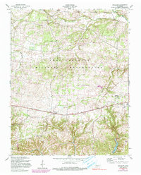
1957 Map of Woodlawn
USGS Topo · Published 1980About this map
The Fort Campbell Military Reservation occupies the northern half of this landscape, its boundary lines cutting through the drainage basins of Piney Fork and Little West Fork. Just south of the military line, a string of rural settlements follows the path of Highway 79, including Woodlawn and Oakwood. The presence of Gate No 11 and a Lookout Tower near the reservation border highlights the mid-century intersection of civilian and military activity in Montgomery County.
Find a feature on this map
19 named features on this map. Tap any name to fly to it.
Don’t see what you’re looking for? This feature index may not catch every label — zoom into the map to look around manually.
Map Details
Editions of this 1957 Woodlawn Map
3 editions found
Other maps of this area

1931 · Erin
USGS Topo · 1:62,500

1944 · Clarksville
USGS Topo · 1:50,000

1951 · Roaring Spring
USGS Topo · 1:24,000

1951 · New Providence
USGS Topo · 1:24,000

1951 · Indian Mound
USGS Topo · 1:24,000

1951 · Herndon
USGS Topo · 1:24,000

1951 · Oak Grove
USGS Topo · 1:24,000

1951 · Woodlawn
USGS Topo · 1:24,000

1956 · Nashville
USGS Topo · 1:250,000

1957 · New Providence
USGS Topo · 1:24,000