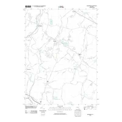
2010 Map of Woodridge
USGS Topo · Published 2010About this map
Woodridge and the surrounding Catskill foothills appear in this 2010 survey as a landscape defined by its numerous water bodies and small, interconnected hamlets. The village of Woodridge is the central hub, situated near the shores of Silver Lake, while the Neversink River flows through the western portion of the quadrangle. The map reveals a dense network of local roads such as Dairyland Rd and Mountaindale Rd, which link historical clusters like Dairyland and Mountain Dale.
Find a feature on this map
85 named features on this map. Tap any name to fly to it.
Don’t see what you’re looking for? This feature index may not catch every label — zoom into the map to look around manually.
Map Details
Editions of this 2010 Woodridge Map
This is the sole edition of this map. No revisions or reprints were ever made.
Other maps of this area

1903 · Slide Mountain
USGS Topo · 1:62,500

1904 · Ellenville
USGS Topo · 1:62,500

1905 · Slide Mountain
USGS Topo · 1:62,500

1906 · Ellenville
USGS Topo · 1:62,500

1909 · Monticello
USGS Topo · 1:62,500

1910 · Neversink
USGS Topo · 1:62,500

1911 · Monticello
USGS Topo · 1:62,500

1942 · Neversink
USGS Topo · 1:62,500

1942 · Lackawack
USGS Topo · 1:24,000
1942 · Ellenville
USGS Topo · 1:24,000