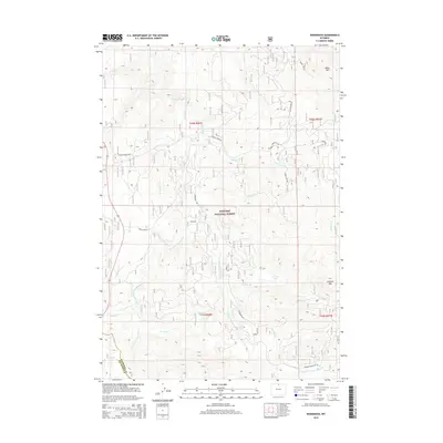
2015 Map of Woodrock
USGS Topo · Published 2015About this map
The Bighorn National Forest headwaters dominate this high-altitude landscape in northern Wyoming, where the complex drainage systems of the S Tongue River and its various branches carve through the Sheridan County wilderness. Small mountain settlements such as Woodrock and Duncan are accessible by a network of forest routes, including Woodrock Rd and Copper Creek Rd. The terrain is defined by significant elevations like Black Mtn in the northeast and Lookout Mtn further south, overlooking the remote Graves Lake. This 2015 survey illustrates the modern management of these timber and water resources, showing the intricate relationship between the many named tributaries like Mohawk Cr, Bonanza Cr, and Prune Cr that feed the larger river system. It serves as a detailed guide to the road network used for forest access, including Primary Forest Rte 26.
Find a feature on this map
35 named features on this map. Tap any name to fly to it.
Don’t see what you’re looking for? This feature index may not catch every label — zoom into the map to look around manually.
Map Details
Editions of this 2015 Woodrock Map
This is the sole edition of this map. No revisions or reprints were ever made.
Other maps of this area

1895 · Dayton
USGS Topo · 1:125,000

1898 · Bald Mountain
USGS Topo · 1:125,000

1901 · Dayton
USGS Topo · 1:125,000

1901 · Bald Mountain
USGS Topo · 1:125,000

1955 · Sheridan
USGS Topo · 1:250,000

1958 · Sheridan
USGS Topo · 1:250,000

1960 · Shell Falls
USGS Topo · 1:24,000

1960 · Granite Pass
USGS Topo · 1:24,000

1962 · Sheridan
USGS Topo · 1:250,000
1964 · Burgess Junction
USGS Topo · 1:24,000