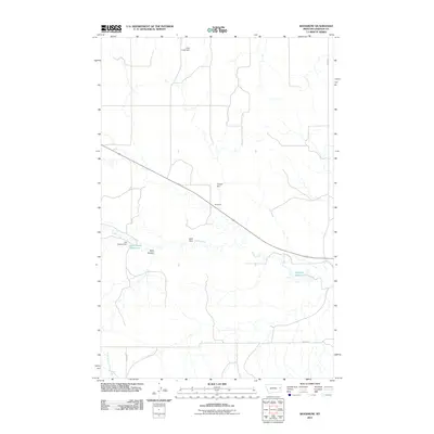
2011 Map of Woodrow
USGS Topo · Published 2011About this map
Woodrow sits at the center of this Dawson County landscape, characterized by a complex network of small-scale water management and drainage features. The area's reliance on localized water storage is evident through several named structures, including Timber Dam, Deer Creek Dam, and Wolff Dam, which regulate the intermittent flow of the Timber Fork. These dams support vital water bodies such as Jack Downs Reservoir and Malkuch Reservoir, illustrating the critical role of surface water management in this part of Montana.
Find a feature on this map
13 named features on this map. Tap any name to fly to it.
Don’t see what you’re looking for? This feature index may not catch every label — zoom into the map to look around manually.
Map Details
Editions of this 2011 Woodrow Map
This is the sole edition of this map. No revisions or reprints were ever made.
Other maps of this area

1909 · Glendive
USGS Topo · 1:250,000

1954 · Glendive
USGS Topo · 1:250,000

1957 · Glendive
USGS Topo · 1:250,000

1958 · Glendive
USGS Topo · 1:250,000
1972 · Pleasant View
USGS Topo · 1:24,000

1972 · Poverty Flat West
USGS Topo · 1:24,000

1972 · Stinking Coulee
USGS Topo · 1:24,000

1981 · Glendive
USGS Topo · 1:100,000

1982 · Circle
USGS Topo · 1:100,000
1983 · Johnson Reservoir
USGS Topo · 1:24,000