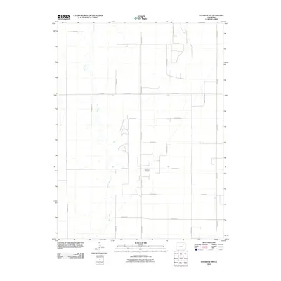
2010 Map of Woodrow NW
USGS Topo · Published 2010About this map
Badger Creek meanders through this portion of Adams County, carving a distinct riparian corridor through a landscape defined by an orderly grid of section lines and gravel routes. In the early 21st century, this rural expanse maintained its agricultural character while supporting localized energy extraction, most notably at the Little Beaver Oil Field. The surveyor's grid is articulated by a series of named thoroughfares including Winview Mile Rd, Pitcairn Mile Rd, and Meridian Rd, which facilitate movement between scattered farmsteads and agricultural plots. The land is largely partitioned by east-west corridors such as E 164th Ave and E 120th Ave, intersecting with a systematic county road network that includes County Road B and County Road D. This map provides a clear record of land use where natural drainage patterns and industrial footprints coexist within the rigid framework of the Public Land Survey System.
Find a feature on this map
22 named features on this map. Tap any name to fly to it.
Don’t see what you’re looking for? This feature index may not catch every label — zoom into the map to look around manually.
Map Details
Editions of this 2010 Woodrow NW Map
This is the sole edition of this map. No revisions or reprints were ever made.
Other maps of this area

1954 · Limon
USGS Topo · 1:250,000

1954 · Sterling
USGS Topo · 1:250,000

1957 · Limon
USGS Topo · 1:250,000

1958 · Limon
USGS Topo · 1:250,000

1958 · Sterling
USGS Topo · 1:250,000

1965 · Gary
USGS Topo · 1:24,000

1965 · Vallery SE
USGS Topo · 1:24,000

1965 · Huey Ranch
USGS Topo · 1:24,000

1973 · Woodrow
USGS Topo · 1:24,000

1973 · Shamrock
USGS Topo · 1:24,000