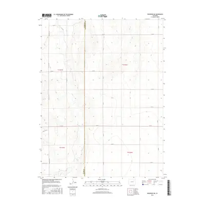
2016 Map of Woodrow NW
USGS Topo · Published 2016About this map
Adams Co and Washington Co meet along a long-established boundary line defined by Meridian Rd in this high-plains landscape. The most prominent natural feature is the winding path of Badger Cr, which creates a subtle riparian corridor through the dry, grid-patterned terrain. The map documents a sparsely populated agricultural region defined more by its section lines and section roads than by urban centers. Local travel and property divisions are marked by a network of named routes including Pitcairn Rd, Winview Mile Rd, and Field Track Rd. This survey highlights the intersection of public land survey systems and the practical necessities of ranching and farming on the eastern Colorado plains, where water sources like Badger Creek dictated early settlement patterns and subsequent land use.
Find a feature on this map
25 named features on this map. Tap any name to fly to it.
Don’t see what you’re looking for? This feature index may not catch every label — zoom into the map to look around manually.
Map Details
Editions of this 2016 Woodrow NW Map
This is the sole edition of this map. No revisions or reprints were ever made.
Other maps of this area

1954 · Limon
USGS Topo · 1:250,000

1954 · Sterling
USGS Topo · 1:250,000

1957 · Limon
USGS Topo · 1:250,000

1958 · Limon
USGS Topo · 1:250,000

1958 · Sterling
USGS Topo · 1:250,000

1965 · Gary
USGS Topo · 1:24,000

1965 · Vallery SE
USGS Topo · 1:24,000

1965 · Huey Ranch
USGS Topo · 1:24,000

1973 · Woodrow
USGS Topo · 1:24,000

1973 · Shamrock
USGS Topo · 1:24,000