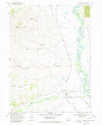
1968 Map of Woodruff
USGS Topo · Published 1980About this map
Woodruff occupies the valley floor where the high-altitude desert meets the irrigated agricultural systems of the late 1960s. The settlement is defined by a dense network of water management features, including the Bear River and numerous hand-cut waterways such as the Sage Creek Canal and Thompson Canal. These diversions support a series of small, strategically placed reservoirs like Limestone Res and Dry Basin Res, reflecting the vital importance of water storage in this arid Utah landscape.
Find a feature on this map
32 named features on this map. Tap any name to fly to it.
Don’t see what you’re looking for? This feature index may not catch every label — zoom into the map to look around manually.
Map Details
Editions of this 1968 Woodruff Map
2 editions found
Other maps of this area

1912 · Randolph
USGS Topo · 1:125,000

1954 · Ogden
USGS Topo · 1:250,000

1958 · Ogden
USGS Topo · 1:250,000

1960 · Ogden
USGS Topo · 1:250,000

1968 · Rex Peak
USGS Topo · 1:24,000

1968 · Randolph
USGS Topo · 1:24,000

1968 · Woodruff
USGS Topo · 1:24,000

1968 · Neponset Reservoir NE
USGS Topo · 1:24,000

1968 · Meachum Ridge
USGS Topo · 1:24,000
1968 · Woodruff Narrows
USGS Topo · 1:24,000