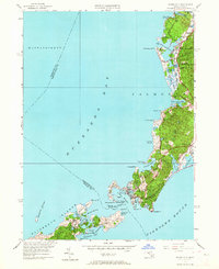
1953 Map of Woods Hole
USGS Topo · Published 1964About this map
Woods Hole and the surrounding coastline of Cape Cod appear here following a 1953 revision, showing a landscape defined by saltwater harbors and a growing seasonal community. The New York New Haven and Hartford railroad line cuts through the interior, connecting the village centers of West Falmouth and Falmouth to the maritime hub at the southern tip. This rail presence highlights the era's logistical dependence on the tracks before the mid-century shift toward highway dominance.
Find a feature on this map
64 named features on this map. Tap any name to fly to it.
Don’t see what you’re looking for? This feature index may not catch every label — zoom into the map to look around manually.
Map Details
Editions of this 1953 Woods Hole Map
4 editions found
Other maps of this area

1885 · New Bedford
USGS Topo · 1:62,500

1886 · Falmouth
USGS Topo · 1:62,500

1887 · Gay Head
USGS Topo · 1:62,500

1887 · Marthas Vineyard
USGS Topo · 1:62,500

1888 · New Bedford
USGS Topo · 1:62,500

1888 · Falmouth
USGS Topo · 1:62,500

1889 · Gay Head
USGS Topo · 1:62,500

1889 · Marthas Vineyard
USGS Topo · 1:62,500

1893 · Gay Head
USGS Topo · 1:62,500

1893 · Falmouth
USGS Topo · 1:62,500