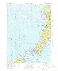
1967 Map of Woods Hole
USGS Topo · Published 1978About this map
Woods Hole and the surrounding coastline of Buzzards Bay appear in high detail during the late 1960s, showing a landscape defined by maritime science and summer residency. The world-renowned Oceanographic Inst sits at the heart of the village near Eel Pond, while the Penn Central railroad tracks terminate at the harbor, marking the importance of this transit hub for the Elizabeth Islands. To the north, the geography of Falmouth and West Falmouth is characterized by intricate tidal systems like the Great Sippewissett Marsh and West Falmouth Harbor.
Find a feature on this map
87 named features on this map. Tap any name to fly to it.
Don’t see what you’re looking for? This feature index may not catch every label — zoom into the map to look around manually.
Map Details
Editions of this 1967 Woods Hole Map
3 editions found
Other maps of this area

1885 · New Bedford
USGS Topo · 1:62,500

1886 · Falmouth
USGS Topo · 1:62,500

1887 · Gay Head
USGS Topo · 1:62,500

1887 · Marthas Vineyard
USGS Topo · 1:62,500

1888 · New Bedford
USGS Topo · 1:62,500

1888 · Falmouth
USGS Topo · 1:62,500

1889 · Gay Head
USGS Topo · 1:62,500

1889 · Marthas Vineyard
USGS Topo · 1:62,500

1893 · Gay Head
USGS Topo · 1:62,500

1893 · Falmouth
USGS Topo · 1:62,500