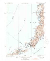
1953 Map of Woods Hole
USGS Topo · Published 1954About this map
Woods Hole and the surrounding coastline of Falmouth are captured here in the early 1950s, showcasing a landscape defined by its intricate glacial topography and maritime heritage. The New Haven and Hartford RR terminates at the harbor, highlighting the area's importance as a transportation hub for both the Elizabeth Islands and the seasonal visitor economy of the mid-century. Dense residential and commercial development is concentrated around Great Harbor and Eel Pond, while the northern reaches near West Falmouth retain a more open character.
Find a feature on this map
67 named features on this map. Tap any name to fly to it.
Don’t see what you’re looking for? This feature index may not catch every label — zoom into the map to look around manually.
Map Details
Editions of this 1953 Woods Hole Map
4 editions found
Other maps of this area

1885 · New Bedford
USGS Topo · 1:62,500

1886 · Falmouth
USGS Topo · 1:62,500

1887 · Gay Head
USGS Topo · 1:62,500

1887 · Marthas Vineyard
USGS Topo · 1:62,500

1888 · New Bedford
USGS Topo · 1:62,500

1888 · Falmouth
USGS Topo · 1:62,500

1889 · Gay Head
USGS Topo · 1:62,500

1889 · Marthas Vineyard
USGS Topo · 1:62,500

1893 · Gay Head
USGS Topo · 1:62,500

1893 · Falmouth
USGS Topo · 1:62,500