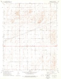
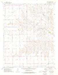
1974 Map of Woods NW
USGS Topo · Published 1976About this map
Gas wells and an extensive network of pipelines dominate this high plains landscape in the mid-1970s, illustrating the intense energy extraction within Center and Moscow townships. The map documents a strictly utilitarian environment where industrial infrastructure, such as the Compressor Station and Radio Tower, sits alongside pockets of Shifting Sand, revealing the wind-blown character of the terrain. Local social and logistical hubs are sparse but critical, evidenced by the Community Hall near the intersection of several primary routes and a small Landing Strip to the south. This survey captures a specific moment in the rural development of the region, where section-line roads and industrial landmarks define the human presence against the natural movement of the soil.
Find a feature on this map
12 named features on this map. Tap any name to fly to it.
Don’t see what you’re looking for? This feature index may not catch every label — zoom into the map to look around manually.
Map Details
Editions of this 1974 Woods NW Map
This is the sole edition of this map. No revisions or reprints were ever made.
Other maps of this area

1944 · Moscow
USGS Topo · 1:62,500

1945 · Moscow
USGS Topo · 1:62,500

1955 · Dodge City
USGS Topo · 1:250,000

1958 · Dodge City
USGS Topo · 1:250,000

1959 · Dodge City
USGS Topo · 1:250,000
1974 · Hugoton SE
USGS Topo · 1:24,000

1974 · Hugoton
USGS Topo · 1:24,000
1974 · Woods SW
USGS Topo · 1:24,000
1974 · Woods SE
USGS Topo · 1:24,000
1974 · Moscow SE
USGS Topo · 1:24,000