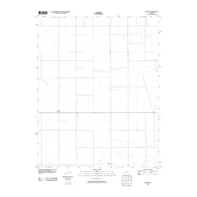
2010 Map of Woods
USGS Topo · Published 2010About this map
Woods and the surrounding plains of Stevens County are defined by a rigid section-line road network characteristic of the High Plains' agricultural development. This 2010 survey by the U.S. Geological Survey captures the landscape centered on the intersection of State Hwy 51 and several significant county thoroughfares, including Marteney and Co Rd C. The map provides a clear look at the sparsely populated area where small settlements like Pleasant Valley and Woods sit amidst vast agricultural fields.
Find a feature on this map
18 named features on this map. Tap any name to fly to it.
Don’t see what you’re looking for? This feature index may not catch every label — zoom into the map to look around manually.
Map Details
Editions of this 2010 Woods Map
This is the sole edition of this map. No revisions or reprints were ever made.
Other maps of this area

1944 · Moscow
USGS Topo · 1:62,500

1945 · Moscow
USGS Topo · 1:62,500

1955 · Dodge City
USGS Topo · 1:250,000

1958 · Dodge City
USGS Topo · 1:250,000

1959 · Dodge City
USGS Topo · 1:250,000

1968 · Sublette SW
USGS Topo · 1:24,000

1968 · Liberal NW
USGS Topo · 1:24,000

1971 · Liberal
USGS Topo · 1:24,000
1974 · Woods SW
USGS Topo · 1:24,000
1974 · Woods SE
USGS Topo · 1:24,000