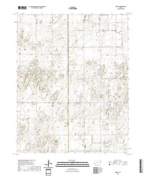
2022 Map of Woods
USGS Topo · Published 2022About this map
Woods sits at the heart of this landscape in southwestern Kansas, positioned along the border where Stevens Co meets Seward Co. The terrain is characterized by the expansive, high-plains geography of the region, where a meticulous grid of rural routes like Marteney and Wettstein Rd facilitates access across large agricultural tracts and range lands. The map illustrates the structured township and range system typical of the era, defined here by t32s r35w and t33s r34w. Water management and land use are evident in the scattered depressions and catchment areas that dot the topography, while local infrastructure is anchored by primary arteries such as Co Rd 9 and Co Rd C. This survey provides a precise view of the rural development and boundary divisions in this part of the state in the early 2020s.
Find a feature on this map
33 named features on this map. Tap any name to fly to it.
Don’t see what you’re looking for? This feature index may not catch every label — zoom into the map to look around manually.
Map Details
Editions of this 2022 Woods Map
This is the sole edition of this map. No revisions or reprints were ever made.
Other maps of this area

1944 · Moscow
USGS Topo · 1:62,500

1945 · Moscow
USGS Topo · 1:62,500

1955 · Dodge City
USGS Topo · 1:250,000

1958 · Dodge City
USGS Topo · 1:250,000

1959 · Dodge City
USGS Topo · 1:250,000

1968 · Sublette SW
USGS Topo · 1:24,000

1968 · Liberal NW
USGS Topo · 1:24,000

1971 · Liberal
USGS Topo · 1:24,000
1974 · Woods SW
USGS Topo · 1:24,000
1974 · Woods SE
USGS Topo · 1:24,000