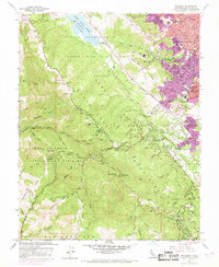
1961 Map of Woodside
USGS Topo · Published 1969About this map
Skyline Boulevard serves as the spine for this Peninsula landscape, tracing the ridge of the Santa Cruz Mountains through the San Andreas State Fish and Game Refuge. The map provides a detailed view of the growing suburban periphery of San Carlos and Redwood City as they push into the foothills, while lower-lying areas like Woodside maintain a more rural character. The presence of the Hetch Hetchy Aqueduct and the Pulgas Water Temple near the Upper Crystal Springs Reservoir illustrates the critical infrastructure of the San Francisco water system during this era.
Find a feature on this map
64 named features on this map. Tap any name to fly to it.
Don’t see what you’re looking for? This feature index may not catch every label — zoom into the map to look around manually.
Map Details
Editions of this 1961 Woodside Map
4 editions found
Other maps of this area

1892 · San Mateo
USGS Topo · 1:62,500

1896 · San Mateo
USGS Topo · 1:62,500

1897 · Palo Alto
USGS Topo · 1:62,500

1899 · Palo Alto
USGS Topo · 1:62,500

1899 · Haywards
USGS Topo · 1:62,500

1899 · San Mateo
USGS Topo · 1:62,500

1902 · Santa Cruz
USGS Topo · 1:125,000

1915 · San Mateo
USGS Topo · 1:62,500

1915 · Haywards
USGS Topo · 1:62,500

1939 · San Mateo
USGS Topo · 1:62,500