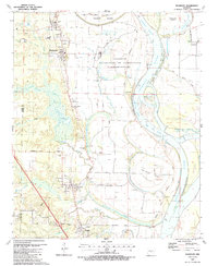
1987 Map of Woodson
USGS Topo · Published 1988About this map
The winding Arkansas River dominates this mid-1980s landscape, defining the boundaries and economic geography of southern Pulaski County. The river’s path is marked by significant features like Warings Bend and the Case Bar Cutoff, which shape Jim Brown Island and Chenault Island. These alluvial lands are crisscrossed by a network of bayous and creeks, including Pennington Bayou and Lorance Creek, which drain the low-lying terrain around the settlements of Wrightsville, Woodson, and Hensley.
Find a feature on this map
48 named features on this map. Tap any name to fly to it.
Don’t see what you’re looking for? This feature index may not catch every label — zoom into the map to look around manually.
Map Details
Editions of this 1987 Woodson Map
2 editions found
Other maps of this area

1891 · Little Rock
USGS Topo · 1:125,000

1893 · Little Rock
USGS Topo · 1:125,000

1932 · Pastoria
USGS Topo · 1:62,500

1935 · Little Rock
USGS Topo · 1:24,000

1935 · Sweet Home
USGS Topo · 1:24,000

1935 · Alexander
USGS Topo · 1:48,000

1935 · Pastoria
USGS Topo · 1:62,500

1939 · Keo
USGS Topo · 1:31,680

1940 · Woodson
USGS Topo · 1:31,680

1941 · Alexander
USGS Topo · 1:62,500