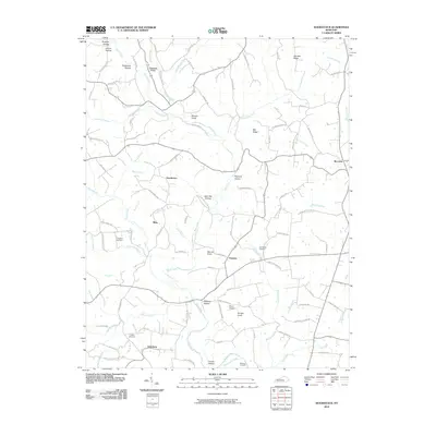
2010 Map of Woodstock
USGS Topo · Published 2010About this map
Buck Creek winds through the heart of this central Kentucky landscape, defining a terrain marked by numerous hollows and knobs. Small rural communities including Goochtown, Clarence, and Estesburg serve as the primary hubs for a network of local roads such as Goochtown Rd and Charles Elgin Rd. The land is characterized by its agricultural and residential pockets, interspersed with prominent geographical features like Muncie Knob and Purcell Knob.
Find a feature on this map
109 named features on this map. Tap any name to fly to it.
Don’t see what you’re looking for? This feature index may not catch every label — zoom into the map to look around manually.
Map Details
Editions of this 2010 Woodstock Map
This is the sole edition of this map. No revisions or reprints were ever made.
Other maps of this area

1893 · London
USGS Topo · 1:125,000

1897 · London
USGS Topo · 1:125,000

1935 · Somerset
USGS Topo · 1:62,500

1952 · Halls Gap
USGS Topo · 1:24,000

1952 · Eubank
USGS Topo · 1:24,000

1952 · Crab Orchard
USGS Topo · 1:24,000

1952 · Shopville
USGS Topo · 1:24,000

1952 · Woodstock
USGS Topo · 1:24,000

1953 · Maretburg
USGS Topo · 1:24,000
1953 · Brodhead
USGS Topo · 1:24,000