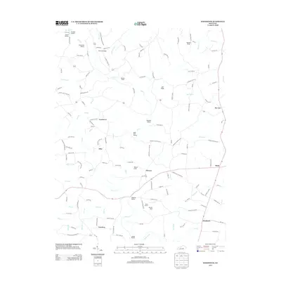
2013 Map of Woodstock
USGS Topo · Published 2013About this map
Goochtown and the surrounding rural landscape of Pulaski County appear here at the start of the 21st century, defined by a network of creeks and prominent ridges. The terrain is shaped by the winding course of Buck Cr, which draws together numerous smaller streams such as Butt Br and Bear Den Hollow. While much of the area is agricultural, the presence of Short Airport near Purcell Knob indicates modern transit infrastructure integrated into the traditional settlement pattern of small communities like Albia and Clarence.
Find a feature on this map
139 named features on this map. Tap any name to fly to it.
Don’t see what you’re looking for? This feature index may not catch every label — zoom into the map to look around manually.
Map Details
Editions of this 2013 Woodstock Map
This is the sole edition of this map. No revisions or reprints were ever made.
Other maps of this area

1893 · London
USGS Topo · 1:125,000

1897 · London
USGS Topo · 1:125,000

1935 · Somerset
USGS Topo · 1:62,500

1952 · Halls Gap
USGS Topo · 1:24,000

1952 · Eubank
USGS Topo · 1:24,000

1952 · Crab Orchard
USGS Topo · 1:24,000

1952 · Shopville
USGS Topo · 1:24,000

1952 · Woodstock
USGS Topo · 1:24,000

1953 · Maretburg
USGS Topo · 1:24,000
1953 · Brodhead
USGS Topo · 1:24,000