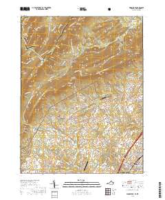
2019 Map of Woodstock
USGS Topo · Published 2019About this map
Woodstock serves as the focal point of this Shenandoah Valley survey, situated along the base of the Massanutten range. The town's historical civic identity is anchored by the Shenandoah County Courthouse, while surrounding rural communities such as Saint Luke, Alonzaville, and Kern Springs illustrate the enduring agricultural and small-town settlement patterns of the region. To the west, the landscape rises sharply into the ridges of the George Washington National Forest, where the terrain is marked by industrial remnants like Van Buren Furnace and Columbia Furnace.
Find a feature on this map
119 named features on this map. Tap any name to fly to it.
Don’t see what you’re looking for? This feature index may not catch every label — zoom into the map to look around manually.
Map Details
Editions of this 2019 Woodstock Map
This is the sole edition of this map. No revisions or reprints were ever made.
Other maps of this area

1891 · Romney
USGS Topo · 1:125,000

1892 · Woodstock
USGS Topo · 1:125,000

1893 · Luray
USGS Topo · 1:125,000

1894 · Winchester
USGS Topo · 1:125,000

1905 · Luray
USGS Topo · 1:125,000

1922 · Wardensville
USGS Topo · 1:62,500

1923 · Middletown
USGS Topo · 1:62,500

1923 · Edinburg
USGS Topo · 1:62,500

1924 · Wardensville
USGS Topo · 1:62,500

1937 · Middletown
USGS Topo · 1:48,000