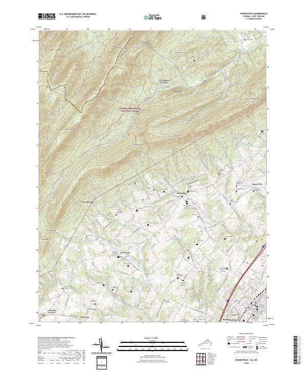
2022 Map of Woodstock
USGS Topo · Published 2022About this map
Woodstock and the surrounding Shenandoah Valley terrain are defined by the linear ridges of the George Washington National Forest, including Little Sluice Mtn and Paddy Mtn. The landscape is dotted with small rural communities like Kern Springs, Alonzaville, and Saint Luke, which are characterized by numerous family and church burial grounds, such as Saint Luke's Lutheran Church Cem and the Haller Family Cem. These sites provide significant genealogical data for the region. The map also records the industrial heritage of the area through the locations of Van Buren Furnace and Columbia Furnace. Transportation and commerce are centered on the Norfolk Southern rail line and the historic Old Valley Pike, which connect the county seat at the Shenandoah County Courthouse to the outlying agricultural and forested lands.
Find a feature on this map
144 named features on this map. Tap any name to fly to it.
Don’t see what you’re looking for? This feature index may not catch every label — zoom into the map to look around manually.
Map Details
Editions of this 2022 Woodstock Map
This is the sole edition of this map. No revisions or reprints were ever made.
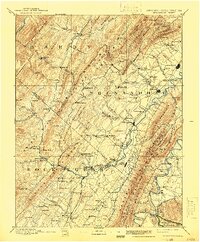
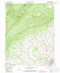
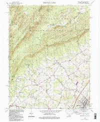
Historical Maps of Van Buren Furnace Through Time
4 maps found