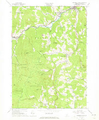
1966 Map of Woodstock South
USGS Topo · Published 1973About this map
Ottauquechee River waters cut through the northern edge of this Windsor County landscape, providing the corridor for the Bridgewater and West Woodstock settlements. The 1960s terrain is defined by its significant elevation changes, from the heights of Long Hill and Old Baldy Mtn to the narrow valleys where South Woodstock and Reading Center are established. Large tracts of the Calvin Coolidge State Forest dominate the southwestern quadrant, illustrating a mid-century balance between preserved timberland and rural development.
Find a feature on this map
54 named features on this map. Tap any name to fly to it.
Don’t see what you’re looking for? This feature index may not catch every label — zoom into the map to look around manually.
Map Details
Editions of this 1966 Woodstock South Map
3 editions found
Other maps of this area

1906 · Hanover
USGS Topo · 1:62,500

1908 · Hanover
USGS Topo · 1:62,500

1911 · Woodstock
USGS Topo · 1:62,500

1913 · Woodstock
USGS Topo · 1:62,500

1926 · Claremont
USGS Topo · 1:62,500

1928 · Ludlow
USGS Topo · 1:48,000

1929 · Claremont
USGS Topo · 1:62,500

1929 · Ludlow
USGS Topo · 1:62,500

1932 · Ludlow
USGS Topo · 1:62,500

1943 · Woodstock
USGS Topo · 1:62,500