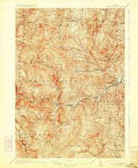
1913 Map of Woodstock
USGS Topo · Published 1923About this map
The Ott Auquechee River serves as the central artery for this part of Windsor County, defining the corridor where the Woodstock RR terminates at Woodstock. This 1910-1911 survey captures a landscape of intense local connectivity, where numerous small hollows and peaks are dotted with a dense network of district schools, including the Stone Brook School and Reading Hill School. The settlement pattern follows the narrow valley floors and brook-fed notches, moving from established hubs like South Woodstock and Bridgewater Corners to the more isolated upland farms around The Gulf.
Find a feature on this map
100 named features on this map. Tap any name to fly to it.
Don’t see what you’re looking for? This feature index may not catch every label — zoom into the map to look around manually.
Map Details
Editions of this 1913 Woodstock Map
5 editions found
Other maps of this area

1891 · Rutland
USGS Topo · 1:62,500

1893 · Wallingford
USGS Topo · 1:62,500

1893 · Rutland
USGS Topo · 1:62,500

1896 · Strafford
USGS Topo · 1:62,500

1906 · Hanover
USGS Topo · 1:62,500

1908 · Hanover
USGS Topo · 1:62,500

1911 · Woodstock
USGS Topo · 1:62,500

1913 · Woodstock
USGS Topo · 1:62,500

1915 · Rochester
USGS Topo · 1:62,500

1917 · Rochester
USGS Topo · 1:62,500