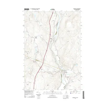
2015 Map of Woodsville
USGS Topo · Published 2015About this map
The Connecticut River serves as the dividing line between Vermont and New Hampshire in this detailed 2015 study of the river valley. The village of Woodsville anchor the southern reach of the map at the confluence with the Ammonoosuc River, which feeds into the Ammonoosuc River Reservoir. To the west, the landscape transitions into the hills of Vermont, marked by small settlements like Boltonville and Ryegate Corner. The transport network follows the river's path, with major arteries such as the Bath-Haverhill Bridge connecting the two states near No Mans Island. Historical interest is found in the numerous burial grounds across the rural landscape, including Pine Grove Cem, Mills Memorial Cem, and Saint Josephs Cem. High points such as Gardner Mtn and Wallace Hill overlook a mosaic of water bodies, from Symes Pond in the north to Ticklenaked Pond and Tenney Pond in the west.
Find a feature on this map
102 named features on this map. Tap any name to fly to it.
Don’t see what you’re looking for? This feature index may not catch every label — zoom into the map to look around manually.
Map Details
Editions of this 2015 Woodsville Map
This is the sole edition of this map. No revisions or reprints were ever made.
Other maps of this area

1929 · Moosilauke
USGS Topo · 1:62,500

1931 · Littleton
USGS Topo · 1:62,500

1931 · Woodsville
USGS Topo · 1:48,000

1932 · Littleton
USGS Topo · 1:48,000

1932 · Moosilauke
USGS Topo · 1:62,500

1935 · Woodsville
USGS Topo · 1:62,500

1935 · Littleton
USGS Topo · 1:62,500

1938 · St. Johnsbury
USGS Topo · 1:48,000

1941 · Woodsville
USGS Topo · 1:62,500

1943 · St. Johnsbury
USGS Topo · 1:62,500