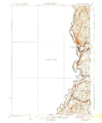
1935 Map of Woodsville
USGS Topo · Published 1935About this map
The Connecticut River serves as the focal point for this mid-1930s survey, marking the boundary between New Hampshire and Vermont. The bustling rail hub of Woodsville sits at the confluence with the Ammonoosuc River, where the Boston and Maine RR lines converge. This era of settlement is defined by small riverside communities like Haverhill and North Haverhill and a rural infrastructure that included the County Poor Farm and local schoolhouses such as the Carbee Sch and West Bath Sch.
Find a feature on this map
30 named features on this map. Tap any name to fly to it.
Don’t see what you’re looking for? This feature index may not catch every label — zoom into the map to look around manually.
Map Details
Editions of this 1935 Woodsville Map
5 editions found

Other maps of this area

1896 · Strafford
USGS Topo · 1:62,500

1928 · Rumney
USGS Topo · 1:62,500

1929 · Moosilauke
USGS Topo · 1:62,500

1931 · Mt. Cube
USGS Topo · 1:62,500

1931 · Littleton
USGS Topo · 1:62,500

1931 · Woodsville
USGS Topo · 1:48,000

1932 · Rumney
USGS Topo · 1:62,500

1932 · Littleton
USGS Topo · 1:48,000

1932 · Moosilauke
USGS Topo · 1:62,500

1933 · Mt. Cube
USGS Topo · 1:62,500