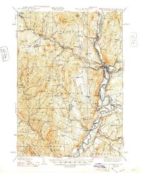
1941 Map of Woodsville
USGS Topo · Published 1948About this map
The Connecticut River forms the central artery of this region, winding through the valley where Newbury and Haverhill sit on opposing banks. The landscape is defined by its industrial and agricultural heritage, shown through the cluster of granite works like Bonazzi Quarry and Gibson Quarry near Ryegate. A dense network of local district schools, including Red Sch and School No 3, serves the scattered upland settlements of Groton and Topsham.
Find a feature on this map
110 named features on this map. Tap any name to fly to it.
Don’t see what you’re looking for? This feature index may not catch every label — zoom into the map to look around manually.
Map Details
Editions of this 1941 Woodsville Map
4 editions found

Other maps of this area

1896 · Strafford
USGS Topo · 1:62,500

1928 · Rumney
USGS Topo · 1:62,500

1929 · Moosilauke
USGS Topo · 1:62,500

1931 · Mt. Cube
USGS Topo · 1:62,500

1931 · Littleton
USGS Topo · 1:62,500

1931 · Woodsville
USGS Topo · 1:48,000

1932 · Rumney
USGS Topo · 1:62,500

1932 · Littleton
USGS Topo · 1:48,000

1932 · Moosilauke
USGS Topo · 1:62,500

1933 · Mt. Cube
USGS Topo · 1:62,500