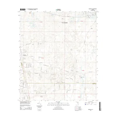
2015 Map of Woodville
USGS Topo · Published 2015About this map
Woodville and the southern outskirts of Tallahassee define this area of the Florida Panhandle, where the land is shaped by the unique hydrology of the St. Marks basin. The geography is dominated by a complex network of sinkholes and springs, most notably at Natural Bridge Sink and Natural Bridge Spring. This karst landscape influenced early infrastructure, with Natural Bridge Road and Old Plank Road navigating the numerous depressions and ponds such as Eagle Lake and Lake Mattie. Small settlements like Corey, Rose, and Vereen appear alongside established family landmarks, including the Rhodes Cem and Godwin Cem. The Saint Marks River flows through the eastern portion of the map, carving through a region where water frequently vanishes into and emerges from the limestone subsurface.
Find a feature on this map
99 named features on this map. Tap any name to fly to it.
Don’t see what you’re looking for? This feature index may not catch every label — zoom into the map to look around manually.
Map Details
Editions of this 2015 Woodville Map
This is the sole edition of this map. No revisions or reprints were ever made.
Other maps of this area

1940 · Tallahassee
USGS Topo · 1:62,500

1940 · Arran
USGS Topo · 1:62,500

1942 · Tallahassee
USGS Topo · 1:62,500

1943 · Arran
USGS Topo · 1:62,500

1943 · Tallahassee
USGS Topo · 1:62,500

1954 · Lloyd
USGS Topo · 1:24,000

1954 · Lafayette
USGS Topo · 1:24,000

1954 · Cody
USGS Topo · 1:24,000

1954 · Woodville
USGS Topo · 1:24,000

1954 · St. Marks NE
USGS Topo · 1:24,000