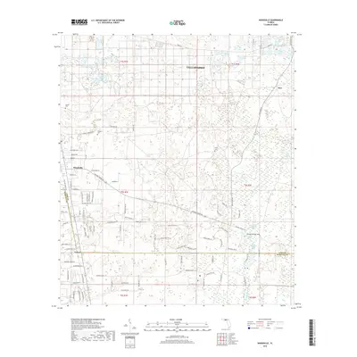
2018 Map of Woodville
USGS Topo · Published 2018About this map
The Saint Marks River and its intricate network of spring-fed hydrology dominate the landscape south of Tallahassee. This topography is defined by karst features where surface waters disappear and re-emerge, most notably at the Natural Bridge Sink and Natural Spring. The settlement at Woodville serves as a local hub, connected to the surrounding countryside by historic corridors like Old Saint Marks Rd and Natural Bridge Rd. To the south, the boundary between Leon and Wakulla counties cuts through the timberlands near Vereen. Genealogists will find interest in localized landmarks such as Rhodes Cem and Kelley Cem, alongside family-named routes like Register Farm Rd and W W Kelley Rd. The northeastern portion is dotted with numerous small water bodies, including Big Lake, Lake Erie, and Homer Lake, illustrating the wet, low-lying character of the region.
Find a feature on this map
93 named features on this map. Tap any name to fly to it.
Don’t see what you’re looking for? This feature index may not catch every label — zoom into the map to look around manually.
Map Details
Editions of this 2018 Woodville Map
This is the sole edition of this map. No revisions or reprints were ever made.
Other maps of this area

1940 · Tallahassee
USGS Topo · 1:62,500

1940 · Arran
USGS Topo · 1:62,500

1942 · Tallahassee
USGS Topo · 1:62,500

1943 · Arran
USGS Topo · 1:62,500

1943 · Tallahassee
USGS Topo · 1:62,500

1954 · Lloyd
USGS Topo · 1:24,000

1954 · Lafayette
USGS Topo · 1:24,000

1954 · Cody
USGS Topo · 1:24,000

1954 · Woodville
USGS Topo · 1:24,000

1954 · St. Marks NE
USGS Topo · 1:24,000