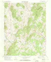
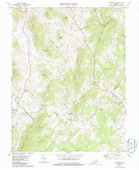
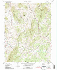
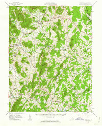
1971 Map of Woodville
USGS Topo · Published 1972About this map
The Hazel River and its many tributaries, including the Hughes River and Blackwater Creek, define the landscape of the Piedmont foothills in the early 1970s. The area is characterized by small rural settlements and family-named corners such as Buckners Corner and Revercombs Corner. Local industry and community centers are anchored by milling sites like Peola Mills and Slate Mills, while spiritual life is centered at Mt Lebanon Ch and Piedmont Ch.
Find a feature on this map
41 named features on this map. Tap any name to fly to it.
Don’t see what you’re looking for? This feature index may not catch every label — zoom into the map to look around manually.
Map Details
Editions of this 1971 Woodville Map
Other maps of this area

1892 · Gordonsville
USGS Topo · 1:125,000

1893 · Luray
USGS Topo · 1:125,000

1905 · Luray
USGS Topo · 1:125,000

1929 · Stony Man
USGS Topo · 1:48,000

1930 · Madison
USGS Topo · 1:48,000

1933 · Stony Man
USGS Topo · 1:62,500

1933 · Madison
USGS Topo · 1:62,500

1949 · Charlottesville
USGS Topo · 1:250,000

1956 · Charlottesville
USGS Topo · 1:250,000
1961 · Sperryville
USGS Topo · 1:62,500