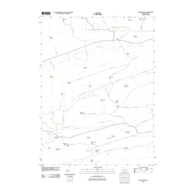
2010 Map of Woodward
USGS Topo · Published 2010About this map
Woodward and Livonia anchor this topographic study of the Ridge-and-Valley Appalachians, where narrow settlements follow the level ground between steep forested heights. The landscape is defined by its deep gaps and hollows, including Hosterman Gap, Wolfs Store Gap, and Hayes Hollow, which serve as natural corridors for local roads like Jackson Hill Rd and Stover Gap Rd. The drainage pattern is particularly intricate, with Elk Creek and Pine Creek winding through the central valleys, fed by smaller tributaries such as Wohlford Run and Voneida Run. Significant elevations like Nittany Mountain and Winkelblech Mountain isolate the different drainages, while Hairy Johns Picnic Area provides a named public landmark in the southeastern portion of the quadrangle. This 2010 survey details a region where traditional land use patterns persist, constrained by the underlying geology of the Pennsylvania mountains.
Find a feature on this map
70 named features on this map. Tap any name to fly to it.
Don’t see what you’re looking for? This feature index may not catch every label — zoom into the map to look around manually.
Map Details
Editions of this 2010 Woodward Map
This is the sole edition of this map. No revisions or reprints were ever made.
Other maps of this area

1921 · Williamsport
USGS Topo · 1:48,000

1921 · Lock Haven
USGS Topo · 1:62,500

1923 · Lock Haven
USGS Topo · 1:62,500

1923 · Williamsport
USGS Topo · 1:62,500

1937 · Millheim
USGS Topo · 1:48,000

1938 · Mifflinburg
USGS Topo · 1:48,000

1941 · Millheim
USGS Topo · 1:62,500

1943 · Mifflinburg
USGS Topo · 1:62,500

1944 · Williamsport
USGS Topo · 1:62,500

1944 · Lock Haven
USGS Topo · 1:62,500